
Blessed with a tropical climate and endless sunshine, Puerto Rico offers beautiful weather year-round. Located east of the Dominican Republic and west of the Virgin Islands, this stunning archipelago — including the islands of Vieques, Culebra, and Mona — is bordered by the cool Atlantic Ocean to the north and the warm Caribbean Sea to the south.
The weather in Puerto Rico typically features an average temperature of around 80°F (27°C), creating ideal conditions for beach days, outdoor adventures, and sightseeing at any time of the year. Whether you're planning to hike the rainforest, relax on pristine beaches, or explore historic towns, understanding the Puerto Rico climate will help you make the most of your trip.
Before heading out to enjoy the Island’s waters, be sure to check local conditions to ensure a safe and memorable experience.
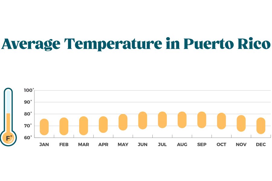
Average Temperature in Puerto Rico
Thanks to its tropical marine climate, Puerto Rico enjoys warm temperatures year-round. The average temperature in Puerto Rico typically ranges from 70°F (21°C) to 85°F (29°C), making it an ideal destination for beach lovers, adventurers, and cultural explorers alike. Expect the hottest months between June and October, while December through March offer slightly cooler but still pleasant weather.
Rainy Season in Puerto Rico
The rainy season in Puerto Rico usually runs from April through November, with the highest rainfall occurring in August, September, and October. Showers tend to be brief and refreshing, often followed by sunshine. Even during the rainy season, visitors can still enjoy plenty of outdoor activities, as rain rarely lasts all day.
Hurricane Season
As classified by the National Weather Service, the hurricane period in the Caribbean is from June 1 until November 30, coinciding with the wet season, where rainfall is a regular occurrence in most regions. Fear of hurricanes shouldn’t make you reluctant to visit Puerto Rico since highly destructive storms are not that common.
Get the Latest Weather Updates
Get daily Puerto Rico weather updates at the official X account for the National Weather Service in San Juan
Best Time to Visit Puerto Rico Based on Weather
Puerto Rico enjoys fantastic weather year-round, but the best time to visit depends on your preferences for crowds, activities, and weather.
High Season (December to April)
For pleasant temperatures and lower humidity, visit during the high season, from December to April. This is the ideal time for outdoor activities like hiking, sightseeing, and beach days. However, expect higher prices and larger crowds, especially in popular areas like San Juan and Vieques.
Low Season (May to November)
The low season brings hotter temperatures and a higher chance of rain, but it’s perfect for avoiding crowds and enjoying lower accommodation rates. Although the weather is warm, keep in mind that hurricane season (June to November) falls within this period, so stay updated on weather forecasts.
Hurricane Season Considerations
Hurricane season runs from June to November. While not every year brings major storms, check forecasts and advisories if you visit during this period. Many travelers choose this time for better deals, but always plan ahead.

Beach & Water Safety in Puerto Rico
Puerto Rico’s beautiful beaches and rivers offer year-round opportunities for fun and relaxation. However, it’s essential to stay safe while enjoying these natural wonders.

To make sure you and your loved ones have a safe, fun day on the water, we encourage you to read this information.

Rip Currents
Rip currents are powerful flows of water pulling away from the shore. These can occur at any beach with breaking waves, especially during bad weather.
If caught in a rip current:
- Stay calm to conserve energy.
- Swim parallel to the shoreline to escape the current.
- Once out, swim at an angle towards the shore.
- If you can’t swim, float, keep your head above water, and signal for help by waving your arm.
Always pay attention to safety signs and listen to lifeguards to stay informed.
If you see a flag this color, it means:

Wind and wave conditions are not expected to develop rip currents. However, they can sometimes occur near groins, jetties, and piers.

Wind and wave conditions support stronger or more frequent rip currents. Only experienced surf swimmers should enter the water.

Wind and wave conditions support dangerous rip currents. Rip currents are life-threatening to anyone entering the surf.
Swim safely!

Flash Flood Warnings in Puerto Rico
Flash floods can happen suddenly, often within minutes of intense rainfall, and can cause significant damage like washing away trees, boulders, and buildings. They are most common with slow-moving or repeated thunderstorms.
Key factors that contribute to flash flooding include the amount of rainfall, the conditions of the soil, and the landscape of the area. Flash floods are especially dangerous in mountainous regions where mudslides can also occur.

Types of flooding
River Flooding: Occurs with seasonal rains or tropical storms.
Coastal Flooding: Caused by winds from tropical storms pushing ocean water inland.
Urban Flooding: Results from rainwater not being absorbed by concrete or asphalt.
During a flash flood warning, avoid bodies of water and mountain areas. Never attempt to walk, swim, or drive through floodwaters. Always turn around if you encounter swift-moving water, and stay informed on weather alerts
Air Quality in Puerto Rico
Air pollution can affect health, and air quality in Puerto Rico can vary daily. The Environmental Protection Agency (EPA) uses the Air Quality Index (AQI) to track pollution levels. The AQI scale runs from 0 to 500, with higher values indicating poorer air quality.
An AQI between 0-50 is considered good, while 51-100 is moderate. When AQI levels reach 101-150, the air is considered unhealthy for sensitive groups, and values above 150 are categorized as unhealthy for everyone. When AQI exceeds 200, air quality is very unhealthy, and over 300 is considered hazardous.
Be mindful of air quality, especially when AQI levels rise above 100, as it can affect those with respiratory conditions or other sensitivities.

0-50 Good

51-100 Moderate

101-150 Compromised

151-200 Unhealthy

201-300 Very Unhealthy

301- 500 Hazardous
Prevent Mosquito Bites
Puerto Rico's tropical climate feels like summer all year long, but it also provides an ideal environment for mosquitoes. These tiny pests can be more than just an itchy annoyance; some mosquitoes can transmit diseases such as dengue, Zika, and chikungunya.
To protect yourself and your family from mosquito bites that can make you sick, use Environmental Protection Agency (EPA)-registered insect repellents, and if you are using sunscreen, apply sunscreen first and insect repellent second. Wear loose-fitting, long-sleeved shirts and pants, and consider clothing and gear treated with permethrin, an insecticide that kills or repels mosquitoes. Make sure to follow these precautions to ensure you have a safe and enjoyable trip!
Puerto Rico Weather FAQs
Does Puerto Rico have a rainy season?
Yes, Puerto Rico experiences a rainy season from April to November, with the heaviest rainfall typically occurring in the late summer and fall. However, even during the rainy season, showers are usually brief, and there are plenty of sunny hours to enjoy.
Is it safe to visit Puerto Rico during hurricane season?
While hurricane season runs from June to November, it doesn’t mean storms are guaranteed. Most storms are not severe, but it’s essential to monitor the weather closely. If you're visiting during this time, keep updated on forecasts and advisories to ensure your safety.
What is the average temperature in Puerto Rico?
Puerto Rico enjoys an average temperature of around 80°F (27°C) year-round, with slight variations between day and night. Expect warm, tropical conditions, perfect for enjoying the beaches and outdoor activities.
Does it rain all day during the rainy season?
No, rain in Puerto Rico typically doesn’t last all day during the rainy season. Showers are often brief and heavy, with clear skies returning shortly after. These rain showers are most common in the afternoons, especially in the mountainous regions of the island. Coastal areas, particularly on the southern side of Puerto Rico, tend to be drier. If it rains during your visit, consider it an opportunity to explore Puerto Rico's indoor attractions or enjoy the tropical showers.
What is the driest month in Puerto Rico?
The driest months in Puerto Rico are generally January to April. During these months, you can expect plenty of sunshine and lower humidity, making it ideal for beach outings and outdoor adventures. The combination of pleasant temperatures and minimal rainfall makes this the peak travel season, so expect larger crowds and higher hotel prices.
Comment Guidelines
We value your thoughts and want to foster a respectful and engaged community. As such, we ask that you adhere to the following guidelines when posting comments
- Please ensure your opinions are expressed respectfully.
- We won’t remove comments that engage in courteous debate but hate speech or any form of profanity will not be tolerated. This also applies to the inappropriate use of emojis or hashtags.
- Do not downvote or dislike a comment simply because you disagree with another person’s views.
- Self-promotion and external links are not allowed and will be removed.
- Avoid sharing private information about yourself or others. Doxing (the act of leaking personal information with harmful intent) is strictly prohibited and will result in a ban.
- Comments that are off-topic will be deleted.
Recommended Articles

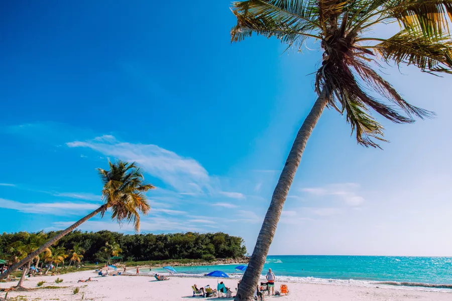
Whether by the shade of trees or a cabana, Puerto Rico's beaches are the perfect place to relax.
4 Reasons to Plan a Vacation to Puerto Rico
If “unforgettable” is how you want to describe your vacation, Puerto Rico should is your place.

Remote Work FAQs
From connectivity to renting a car, find answers to common remote work questions here.

Winter Escape: Off-The-Beaten-Path in Puerto Rico for 5 Days
There's a good reason why Puerto Rico's popularity as a destination spikes during the winter.
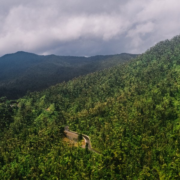
El Yunque is the only tropical rainforest in the US National Forest System.
Virtual Tour through Puerto Rico’s Natural Wonders
Take a guided tour through some of the island’s most pristine locations.
Escambrón Beach in San Juan.
Off-the-Beaten-Path Surf Beaches in Puerto Rico
Ride some waves in the Island's most pristine surf locations.

Modern city culture meets Old World charm in Puerto Rico.
Top 10 Reasons to Work Remote in Puerto Rico
Puerto Rico’s astonishing natural beauty makes it an alluring place to live and work, but beauty is just the beginning.