
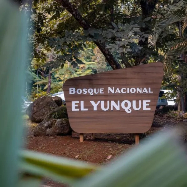
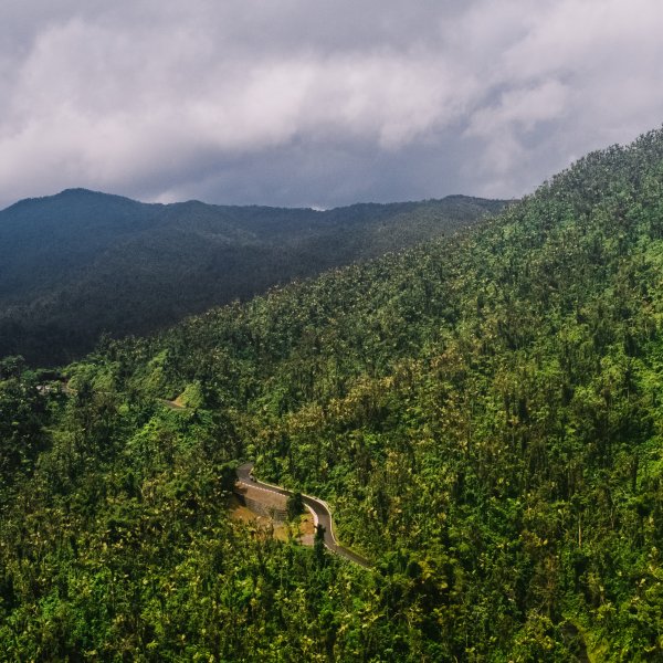
Step into Puerto Rico’s rainforest and experience the magic of El Yunque trails—where every step brings you closer to hidden waterfalls, tropical wildlife, and panoramic vistas. Whether you're looking for an easy nature walk or a more challenging hike, these trails showcase the beauty and biodiversity of the only tropical rainforest in the U.S. National Forest System.
Get out your hiking boots and athleisure wear (and maybe a raincoat) to explore one of these popular trails.
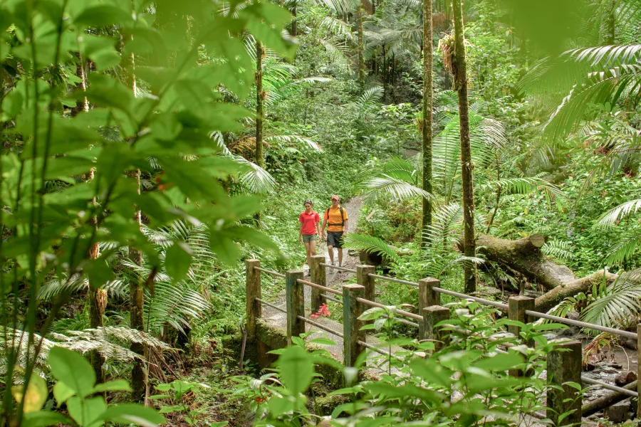
Exploring the trails of El Yunque National Forest offers more than breathtaking scenery—it’s an opportunity to connect with nature.
Easy Trails in El Yunque
If you're looking for a gentle introduction to hiking in El Yunque National Forest, there are several beginner-friendly trails perfect for all ages. These paths are generally well-marked, shorter in distance, and offer rewarding views without steep climbs.
One of the easiest options when hiking in El Yunque is the Caimitillo Trail. Other favorites are the Angelito Trail, a flat and easy walk that ends at a refreshing river pool—ideal for a quick dip after your hike, or Los Picachos .
Caimitillo Trail
Difficulty: Easy
Distance: 0.4 miles / 0.6 km (one way)
Elevation: 2,067 to 2,427 feet / 630-740 meters
Location: Road 191 km 12.1
One of the easiest hikes in El Yunque is just 100 feet south of the Sierra Palm Visitor Center on Road 191 km 12.1. This short 0.4 to 0.6-mile walk is ideal for those who want to enjoy what the rainforest has to offer but are not ready to take on a more challenging trail. It is excellent if you're going to exercise with young ones or pets. Along the trail, you'll find many picnic spots with tables and barbecue pits, giant fern trees, beautiful wildflowers, and streams. This trail is the best opportunity for a "quick" nature trip and birdwatching.
Angelito Trail
Difficulty: Easy
Distance: 0.2 miles / 0.4 km (one way)
Elevation: 492-360 feet / 150-110 meters
Location: Road 988 km 3.6
This popular and easy hike ends with a refreshing natural pool at the Wild and Scenic Río Mameyes (Mameyes River). El Angelito trail is about a half-mile long and takes around 20 minutes to complete one way, making it ideal for families with children. The path is primarily used for walking and nature trips and is accessible year-round. It tends to be less crowded and shows a different type of vegetation than what you'll find on the upper side of the rainforest. Although it starts packed with gravel, the pathway is uneven and becomes muddy after rain – nothing you can't wash off later in the river.
Los Picachos
Difficulty: Easy
Distance: 0.2 miles / 0.3 km
Elevation: 3,175 feet / 968 meters
Location: Accessed through El Yunque Trail
Although it is an easy 0.2-mile hike, to reach this trail, you'll need to travel about two miles up El Yunque Trail. The path, which leads to a panoramic view of the Island’s east coast, includes a section of steep stairs and may be muddy and slippery, but the scenery in the cloud forest makes up for all the effort. It is recommended to stop here before continuing to El Yunque Peak.
Trails for Adventurous Hikers
For experienced hikers looking to push their limits, El Yunque National Forest offers several challenging trails that wind through steep terrain, dense rainforest, and high elevations. Trails like El Toro and Mount Britton require endurance and preparation—but reward you with panoramic views, cloud forests, and a true sense of accomplishment. Bring proper gear, water, and expect changing weather conditions as you ascend.
Mount Britton Trail & Tower
Difficulty: Challenging
Distance: 0.8 miles / 1.3 km (one way)
Elevation: 2,493-3,087 feet / 760-940 meters
Location: Road 191 near km 13
Once you reach the top, you'll be surrounded by clouds! This 0.8-mile, out-and-back trail starts just off of Road 191 heading toward the Mount Britton lookout tower. The hike is around 45 minutes long, climbing up on paved pathways through the sierra palm and into the cloud forest. The narrow trail is labeled "challenging" by the U.S. Forest System. While it’s not as difficult as the label might suggest, keep in mind that it is steep in some places, and the humidity and rain can make the trail slippery at times.
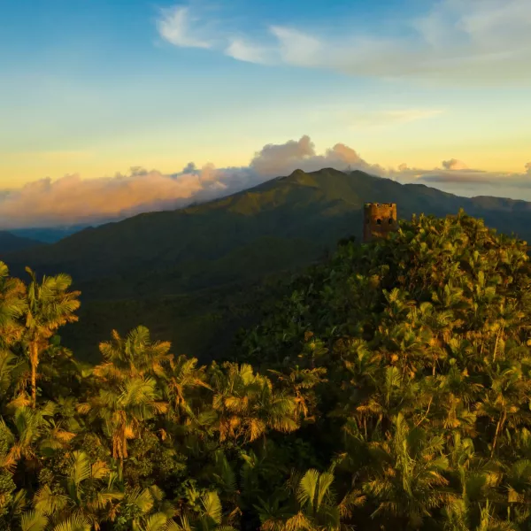
The path has three covered rest stations on the way up and connects to the El Yunque Trail, which leads to the peak (about another hour uphill). The Mt. Britton observation tower was built in the 1930s by the Conservation Corps and is named after famous botanist Nathaniel Britton. It has an elevation of 3,087 feet and climbs 594 feet in less than a mile. The scenic views from the tower span across the forest all the way to the Atlantic Ocean and the Caribbean Sea.
El Yunque Trail
Difficulty: Challenging
Distance: 2.6 miles / 4.2 km (one way)
Elevation: 2,067-3,445 feet / 630-1,050 meters
Location: Road 191 km 12.0
From Caimitillo Trail or Mt. Britton Trail, you can join up with El Yunque Trail to continue up to one of the highest points in the rainforest – El Yunque Peak. You will gain nearly 1,400 feet as you climb through Palo Colorado forest, sierra palms, and cloud forest to the peak, which offers incredible views in all directions. The trail is a mix of asphalt, gravel, and natural stone. It can be muddy at times, so watch your step!
El Toro Wilderness Trail
Difficulty: Difficult
Distance: 2.3 miles / 3.8 km (one way)
Elevation: 2,132-3,533 feet / 650-1,074 meters
Location: Road 186 km 10.8
Hike to the highest point of the rainforest along a challenging and steep trail. The 4.9-mile out-and-back pathway known as El Toro is uneven and requires you to climb over rocks and fallen trees, which means you'll get a full workout and be somewhat muddy. During the hike, you'll be able to enjoy the varied flora of the forest, changing from tabonuco to fern trees and sierra palms the higher up you get. El Toro is more secluded than the other trails in El Yunque, so it is recommended not to wander off the designated path in order to protect the natural environment and prevent accidentally getting lost.
La Coca Trail offers a walk in the lower forest among the Tabonuco forest and is a very difficult and challenging trail.
La Coca Trail
Difficulty: Very challenging
Distance: 1.8 miles / 2.9 km (one way)
Elevation: 820-1,476 feet / 250-450 meters
Location: Road 191 km 8.5
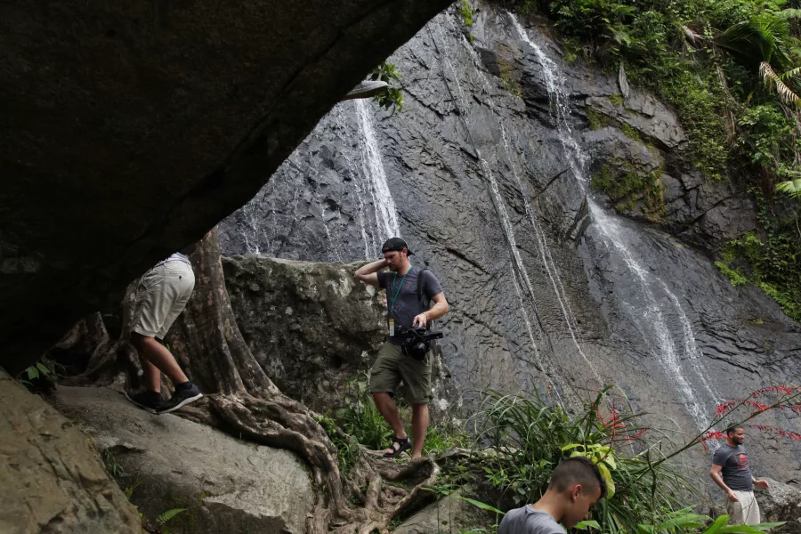
Prepare to get muddy! Near La Coca waterfall along Road 191 is a very challenging path that posts an elevation change of 656 feet. This trail offers a walk in the lower part of the tabonuco forest. It runs for 1.8 miles one way and requires some effort, so be sure to pack extra water for the uphill return. The natural surface trail has very steep slopes and difficult parts with various streams and river crossings. The trail ends at the Río Mameyes, which is a designated Wild and Scenic river. Be sure to stay on the designated path and follow the markers placed along the way.
No Reservation Required!
El Yunque is a very popular place to visit and you won't need to make a reservation.
Note: Please check the El Yunque U.S. Forest website for the latest information about weather, park closures, and safety protocols.
If you're up for a challenge, hike to Mt. Britton Tower and then continue on to El Yunque Peak.
Hiking Tips for El Yunque
Start Early
Begin your hike in the morning to avoid afternoon rain showers and crowded trails. Early hours also offer cooler temps and better chances of spotting wildlife.
Check the Weather
El Yunque’s tropical climate can shift fast. Look up the latest weather conditions and trail advisories before you go—especially during the rainy season.
Dress for the Terrain
Wear sturdy, waterproof hiking shoes with good grip. Lightweight, breathable clothing and a rain jacket will help you stay dry and comfortable on the trail.
Pack Smart
Bring water, snacks, sunscreen, bug repellent, and a fully charged phone. Cell service can be spotty, so consider offline maps or a printed trail guide.
Plan a Getaway to Puerto Rico
Discover lush rainforests, stunning beaches, and vibrant culture in Puerto Rico. Start planning your unforgettable island escape today!
What should I wear for hiking in El Yunque?
Wear moisture-wicking clothes, sturdy hiking shoes with good grip, and pack a light rain jacket. El Yunque’s weather can change quickly.
Which trail in El Yunque is best for beginners?
The Big Tree Trail is a top pick for beginners. It’s well-maintained, relatively flat, and leads to the stunning La Mina Falls.
Is it safe to hike in El Yunque alone?
Yes, many people hike solo, but it's best to stick to popular, marked trails. Let someone know your route and check conditions before heading out.
Can you hike El Yunque without a tour?
Yes, you can hike El Yunque on your own. Self-guided hiking is allowed on all public trails, as long as you have a valid reservation and follow posted guidelines.
Do I need a reservation to hike in El Yunque?
Yes, reservations are required to enter the main recreation area. Visit the official U.S. Forest Service website to book in advance.
Are pets allowed on El Yunque trails?
Pets are allowed on certain trails but must be leashed at all times. Be sure to check trail-specific guidelines before bringing your furry friend.
Comment Guidelines
We value your thoughts and want to foster a respectful and engaged community. As such, we ask that you adhere to the following guidelines when posting comments
- Please ensure your opinions are expressed respectfully.
- We won’t remove comments that engage in courteous debate but hate speech or any form of profanity will not be tolerated. This also applies to the inappropriate use of emojis or hashtags.
- Do not downvote or dislike a comment simply because you disagree with another person’s views.
- Self-promotion and external links are not allowed and will be removed.
- Avoid sharing private information about yourself or others. Doxing (the act of leaking personal information with harmful intent) is strictly prohibited and will result in a ban.
- Comments that are off-topic will be deleted.
Recommended Articles
El Yunque is the only tropical rainforest in the US National Forest System.
Virtual Tour through Puerto Rico’s Natural Wonders
Take a guided tour through some of the island’s most pristine locations.

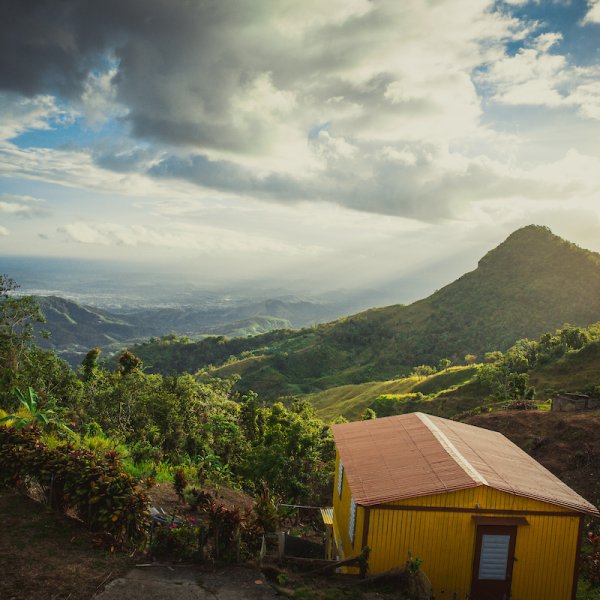
Panoramic view from Finca Viernes in Utuado.
How to Plan a Sustainable Trip to Puerto Rico
Enjoy a vacation that is both beautiful and environmentally conscious.
A mesmerizing view of the Yauco mountains.
Unique Outdoor Experiences in Puerto Rico
Find diverse activities in paradise.
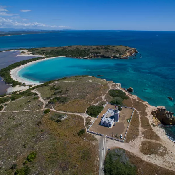
Los Morrillos Lighthouse and the beaches of Cabo Rojo National Wildlife Refuge.
The Best Easy Hikes in Puerto Rico
These trails are easily accessible and give visitors the chance to explore more of Puerto Rico.
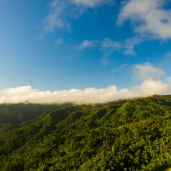
Immerse yourself in nature at El Yunque National Forest.
Things to Do in Río Grande
Enjoy a tropical adventure surrounded by nature and beauty.

Aerial view of the mangrove island Cayo Aurora, also known as Gilligan's Island.
Things to Do in Guánica
A natural paradise full of ecological diversity and marine wonders.