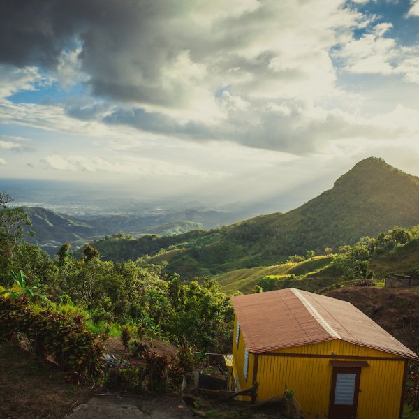
Prepare to get sweaty and enjoy some of the best views the island has to offer.
Push your limits and be handsomely rewarded.
The best part of a challenging hike, the type that requires ropes, trekking poles, hours of walking, and more water and snacks than you think you'll need, is that when you reach the peak, the beach, the bottom of the canyon, the payoff is that much sweeter for your extraordinary effort. Puerto Rico has several such hikes, each with radically different conditions and requirements.
Get your gear together, make sure you're physically fit, and don't forget your camera.
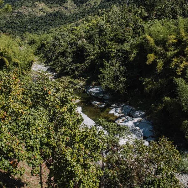
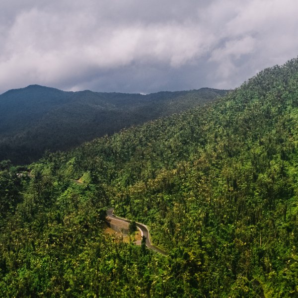
Aerial view of the mountains of Jayuya.
Tres Picachos
The municipality of Jayuya in the island’s Cordillera Central (central mountain range) has several imposing peaks, including Cerro Punta, the highest point in Puerto Rico. But for a challenging hike, head to Los Tres Picachos, a three-peaked, 3,953 ft mountain with an ascent so steep, there are ropes tied to the trees to help hikers go up. The view from the top is breathtaking and the adventure of climbing will make it even more meaningful.
Ascent and descent take around two and a half hours each way and require hikers to be in excellent physical condition. Long pants, hiking shoes, and a windbreaker are recommended, as well as enough food and water for the long hike. Be aware that rain can cause mudslides around the trail.
El Yunque is the quintessential stop for nature lovers and hiking aficionados.
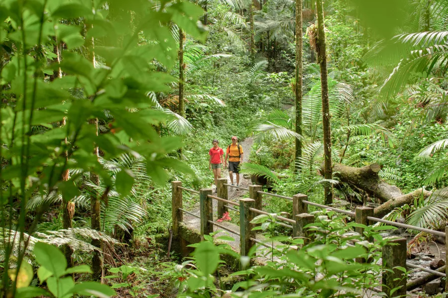
El Toro Trail at El Yunque
El Toro trail takes you to the highest point of the El Yunque rainforest. The trail is muddy, parts of it are unkempt and require climbing over rocks and trees, but for the most part, it's a smooth trail with a steep descent upon reaching El Toro Peak. The forest landscape changes from tabonuco trees to sierra palms to stunted trees near the top, which is what they call the "cloud forest." Wear long pants and long sleeves that are breathable in heat and humidity, shoes with great traction, and bring plenty of food and water. Since the canopy is still filling out, sunscreen is also a good idea.
El Toro Trail used to connect with the Trade Winds trail but this one is still closed to the public. Since El Toro is more remote than the more "mainstream" El Yunque trails, please be sure to stay on the trail itself and not wander off.
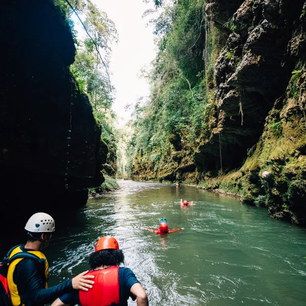
Cañón San Cristóbal
Cañón San Cristóbal is a 5.6-mile canyon created by tectonic movements which essentially split open the central mountain range. The Usabón river crosses the bottom of the canyon which also contains natural swimming holes and some of the most impressive waterfalls in Puerto Rico. This is a hike that requires a guide and safety equipment because both descending and ascending are incredibly steep and tricky. Several companies like Go Hiking Puerto Rico and Para La Naturaleza, the nonprofit conservation organization that acquired the canyon and gave it protected status, organize excursions of different difficulty levels, some just hiking, others with rappelling included.
Ballena and Lluberas Trails at the Guánica Dry Forest
This is probably the "easiest" of the challenging hikes since the ascent and descent are doable even for the average hiker. What will test you is the heat. You'll be crossing a subtropical dry forest with desert-like conditions and the length of the hike will take you into the hottest parts of the day.
The Ballena trail reaches Ballena beach at the bottom of the Bosque Seco de Guánica and you can continue your hike along the beach to the mangrove area at the end. But eventually you need to come back up the mountain. The Lluberas trail is the longest trail in the Dry Forest at nearly 10 miles round trip and has several side trails, some reach the beach at the bottom of the mountain and one called Cueva reaches several limestone caves.
To enter the reserve, visit the ranger station (located at the top of the mountain) where you check in and receive a map. The ranger is happy to recommend trails depending on how long you want to be out. Bring plenty of water and food, clothes that breathe but will protect you from the sun, sturdy shoes, and insect repellent.
This forest is best visited during the "winter" months; during the summer the heat rises substantially and can be dangerous.
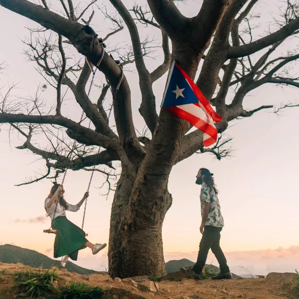
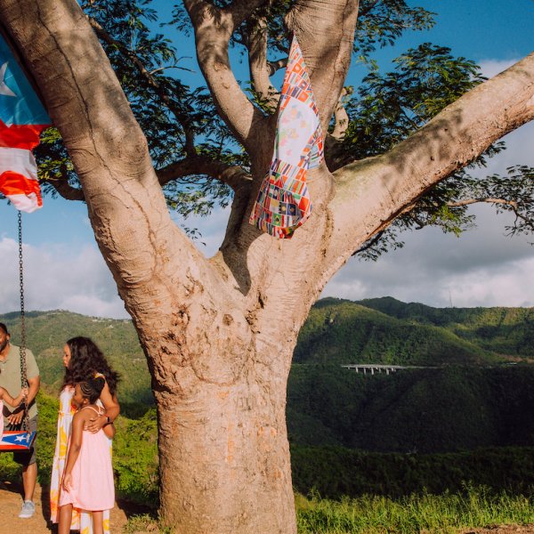
The name of the mountain itself is Cerro de los Cielos but the trail gets its name from the solitary mango tree at the top which is visible from the highway
Árbol Solitario
Árbol Solitario, the lonely tree, is a famous trail locally, despite the steep, more than 90-minutes and nearly 2,000-foot ascent. But it's all worth it for the panoramic view of the mountains stretching all the way to the Caribbean Sea. The name of the mountain itself is Cerro de los Cielos but the trail gets its name from the solitary mango tree at the top which is visible from the highway. The tree has two swings attached to its branches and further down the trail there are also flagpoles with tattered remains of several flags. All of these are prime photo opportunities.
The trail became somewhat infamous in 2016 because people used to park on the highway emergency ramp (which is illegal) for a shorter route up to the tree. Many ended up getting lost on the way up causing a huge headache for the local police. To reach the "official" trailhead, you need to get off the PR-52 highway to the PR-1 road in the direction of Cayey, there is a parking lot at Hacienda Los Maldonado. From there you can head up the mountain.
Comment Guidelines
We value your thoughts and want to foster a respectful and engaged community. As such, we ask that you adhere to the following guidelines when posting comments
- Please ensure your opinions are expressed respectfully.
- We won’t remove comments that engage in courteous debate but hate speech or any form of profanity will not be tolerated. This also applies to the inappropriate use of emojis or hashtags.
- Do not downvote or dislike a comment simply because you disagree with another person’s views.
- Self-promotion and external links are not allowed and will be removed.
- Avoid sharing private information about yourself or others. Doxing (the act of leaking personal information with harmful intent) is strictly prohibited and will result in a ban.
- Comments that are off-topic will be deleted.
Recommended Articles
Virtual Road Trip Around Puerto Rico
Fall in love with the many wonders of the island.
El Yunque is the only tropical rainforest in the US National Forest System.
Virtual Tour through Puerto Rico’s Natural Wonders
Take a guided tour through some of the island’s most pristine locations.
A mesmerizing view of the Yauco mountains.
Unique Outdoor Experiences in Puerto Rico
Find diverse activities in paradise.
The beautiful mountains make for a perfect backdrop in your family photo!
Swings and Benches to Visit in Puerto Rico
Don’t miss the best photo opportunities on the Island.

Wake up and smell... the ocean!
RV Trips around Puerto Rico
Is there anything more carefree than cruising through nature?
Float along the streams of the Tanamá River in Utuado and discover what this mountainous town has to offer.