
Take a walk on the wild side.
Puerto Rico is renowned for its beaches and historic Old San Juan, but what many don't realize is just how numerous the natural areas are for hiking, camping, and other outdoor adventures. On the Island's 3,500 square miles there are national and state forests, nature reserves, cave systems, and dozens of different ecosystems spanning coastal valleys, the karst region, wet and dry forest, and the United States' only tropical rainforest.
If you want to get out and enjoy the natural beauty of the Island, here's a handy guide to help you find the perfect trail.
Descubra una gran variedad de rutas de senderismo en todo Puerto Rico, desde el Bosque Nacional El Yunque hasta humedales y reservas en toda la Isla.
Guánica State Forest & Biosphere Reserve is the best example of a dry forest in the Caribbean region.
Guánica Dry Forest Reserve
On the south side of the Island, you'll find the opposite to El Yunque’s rainforest: the Guánica Dry Forest. The southern side of the Island is more arid — with cacti and other plants better suited to the desert-like conditions — and you’ll often see red-tailed hawks and turkey vultures leisurely circling against a perfectly blue sky. There are numerous trails in the reserve and the ranger at the entrance can provide you with a map. Among the most popular: Ballena leads all the way down the mountain to the beach, La Cueva to limestone caves, and Fuerte Caprón to a historic fort overlooking the coast.
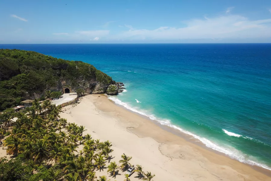
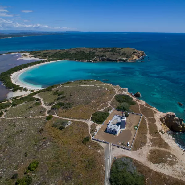
Aerial view of the Guajataca Forest and the beach.
Guajataca Forest
Located in the town of Isabela, the Guajataca Forest has 27 miles of trails, and the two most frequently used are the Interpretative Trail and the trail to Cueva del Viento (Cave of the Wind). You can easily do both on the same day, as well as explore the cave, which is full of otherworldly stalagmite and stalactite structures (as well as bats!). Follow Trail #1 to the cave then take the Interpretative Trail back to the parking area off of PR-446. There's even a side trail to an observation tower as a bonus. The trail is easy to walk but bring sturdy shoes with good traction and flashlights if you plan on exploring the cave.
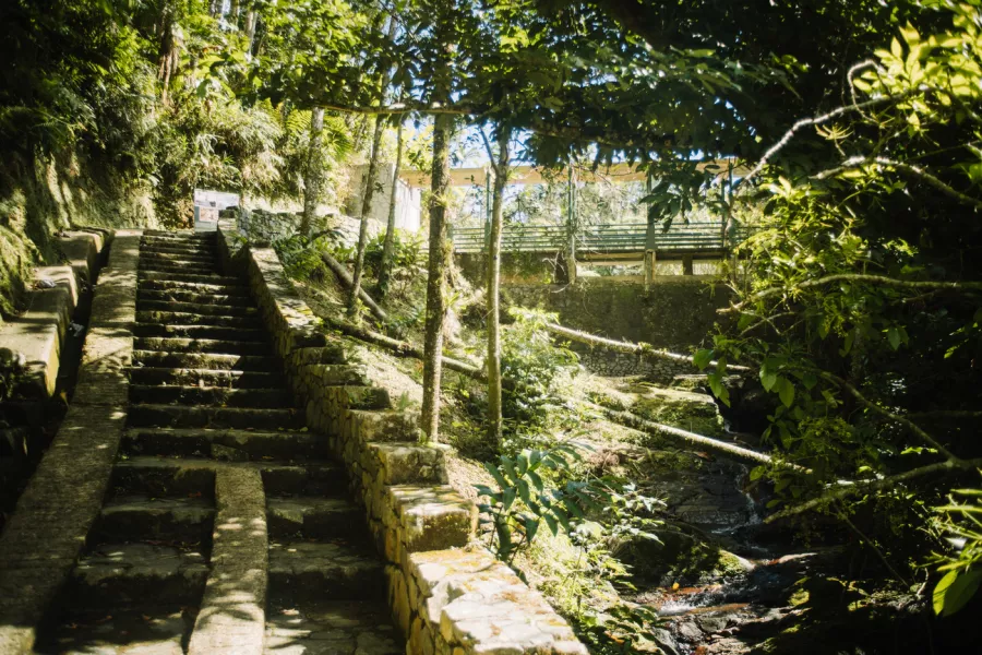
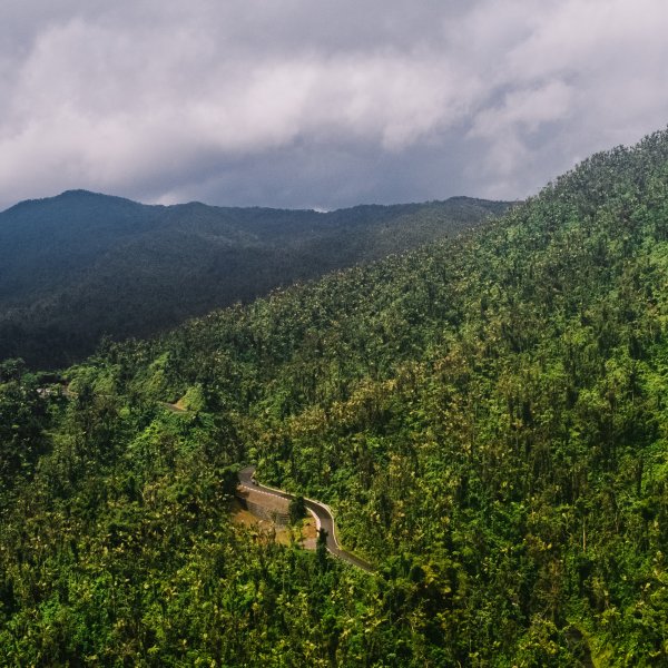
In Toro Negro Forest you can camp and hike while enjoying the waterfalls and rivers.
Toro Negro State Forest
Jayuya/Ponce/Villalba/Orocovis/Ciales/Juana Díaz
The nearly 7,000 acres of Toro Negro State Forest is spread over six different municipalities and includes four types of forest (tabonuco, palm, Micropholis Buchenavia, and a cloud forest), the three highest peaks of the Island (Cerro de Punta, Cerro Jayuya, and Cerro Rosa), a lake, two natural swimming pools, nine rivers, and numerous waterfalls. To hike and camp there, visit the ranger station on Route 143 KM 32.4 in Villalba. Most of the trailheads are concentrated in this area, and the most popular (and currently open) are El Bolo, which leads to a stone tower on the top of a mountain, and Charco La Confesora, which has a trailhead at the Toro Negro camping grounds.
Cambalache State Forest
Cambalache State Forest is the perfect setting for a leisurely hike in nature (mountain bikes also welcome), or enjoy birdwatching and camping. The facilities are easily accessible and include parking, bathrooms, picnic tables and gazebos, and there's even an ornithological center that opens on weekends. During your hike you can spot more than 150 types of trees and shrubs, of which 15 are endemic and 10 are rare or endangered. Birding is also popular here since you can spot 45 species of birds, including 12 of the 17 that are endemic to Puerto Rico.
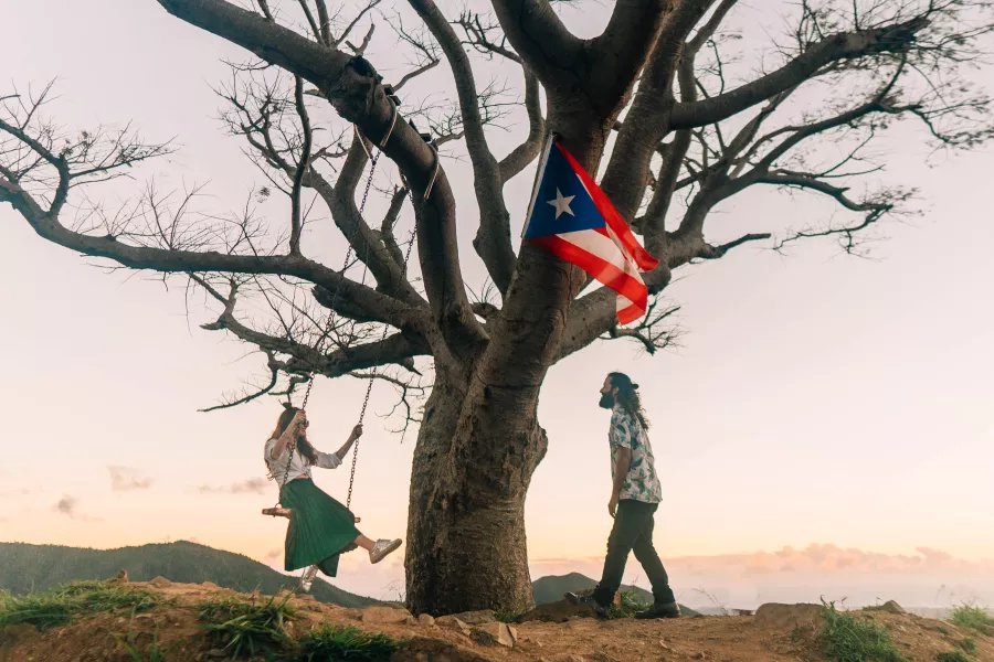
The name of the mountain itself is Cerro de los Cielos but the trail gets its name from the solitary mango tree at the top which is visible from the highway
Árbol Solitario
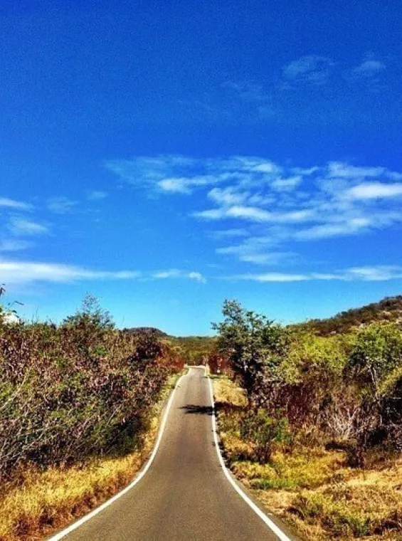
Visible from highway PR-52 just past the Jíbaro Monument in Salinas, there is a lone tree on the top of a tall mountain called Cerro de los Cielos. Until 2016, hiking up to the Solitary Tree was very controversial because people would park their cars on the highway emergency ramp, and since the trail wasn't properly marked many would become lost. Now the "official" trailhead is off PR-1 and takes one hour to 90 minutes to complete via a steep, challenging trail. The view of the southern mountain range stretching all the way to the Caribbean Sea makes it all worthwhile. People have attached swings to the tree and there are also flags near the top making it a perfect place for a photo op.
Cabo Rojo Wildlife Refuge
The Cabo Rojo Wildlife Refuge was established in 1974 in southwestern Puerto Rico and is home to a diversity of flora and fauna that visitors can explore via the park's hiking and biking trails. Much of the refuge consists of subtropical dry forest, meaning conditions are hot and arid most of the year. It's a very popular destination for birdwatching, particularly in the park’s unique salt flats. The Wildlife Refuge is open from Monday to Saturday, while the Salt Flats Interpretative Center is open Thursday to Sunday. Bring water and sunscreen, sturdy hiking shoes, and a camera.
Comment Guidelines
We value your thoughts and want to foster a respectful and engaged community. As such, we ask that you adhere to the following guidelines when posting comments
- Please ensure your opinions are expressed respectfully.
- We won’t remove comments that engage in courteous debate but hate speech or any form of profanity will not be tolerated. This also applies to the inappropriate use of emojis or hashtags.
- Do not downvote or dislike a comment simply because you disagree with another person’s views.
- Self-promotion and external links are not allowed and will be removed.
- Avoid sharing private information about yourself or others. Doxing (the act of leaking personal information with harmful intent) is strictly prohibited and will result in a ban.
- Comments that are off-topic will be deleted.
Recommended Articles
Virtual Road Trip Around Puerto Rico
Fall in love with the many wonders of the island.
El Yunque is the only tropical rainforest in the US National Forest System.
Virtual Tour through Puerto Rico’s Natural Wonders
Take a guided tour through some of the island’s most pristine locations.

Panoramic view from Finca Viernes in Utuado.
How to Plan a Sustainable Trip to Puerto Rico
Enjoy a vacation that is both beautiful and environmentally conscious.
A mesmerizing view of the Yauco mountains.
Unique Outdoor Experiences in Puerto Rico
Find diverse activities in paradise.
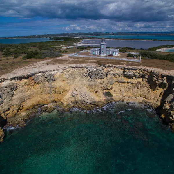
The limestone cliffs that surround Los Morrillos Lighthouse offer unparalleled views of the Island's coastline.
Virtual Tour through Puerto Rico’s Off the Beaten Path
Explore the island and discover roads less traveled.
Los Morrillos Lighthouse and the beaches of Cabo Rojo National Wildlife Refuge.
The Best Easy Hikes in Puerto Rico
These trails are easily accessible and give visitors the chance to explore more of Puerto Rico.